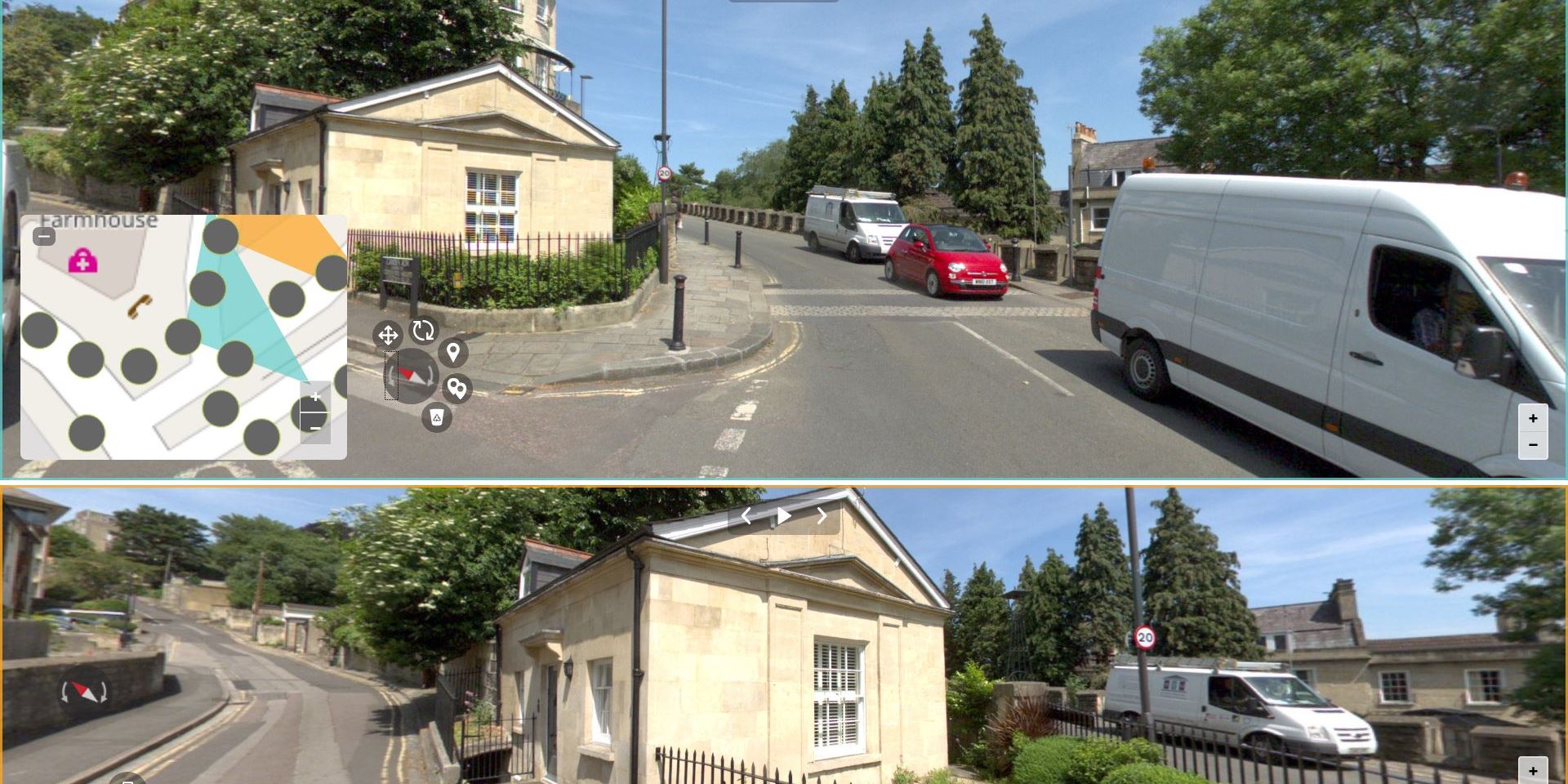
We are pleased to announce the official launch of Obliquo Street, a new product of the Obliquo family.
Obliquo Street is the module of the Obliquo platform that allows you to work with your own panoramic images, especially for working with Mobile Mapping images that include accurate and georeferenced information.
With the addition of this new module, Obliquo completes its geospatial data publishing and analysis capabilities (orthophotos, oblique images, point clouds and 3D scenarios), reinforcing its position as one of the most powerful online platforms on the market. Obliquo Street is fully compatible with any other product on the Obliquo platform, so all of them can be accessed from a single environment.
The high speed, ease of use and flexibility that characterize Obliquo are the hallmarks of this new product. Navigate from anywhere through all your mobile mapping data, without size limits, as if you were on a local machine…
For developers or technicians who require a high level of customization of their applications, Obliquo Street provides a powerful set of APIs for the development of panoramic image-based applications.
Main features
The main features of Obliquo Street are:
- Visualization of any type of panoramic image, using multi-resolution technology.
- Support of images in the different panoramic formats: equi-rectangular and cubic, pre-processed (on demand) to use multi-resolution images (faster), or raw data loading.
- Standalone operation based solely on image. Although it has 100% LIDAR data support (or any information based on point clouds).
- Easily publish any panoramic content online and deploy custom applications based on a basic viewer.
- Support for advanced measurements by triangulation, GIS layer overlay, object extraction, profiling or volumetric analysis.
- Pre-processing of mobile mapping and online publishing projects: content detection, generation of custom overlays (traffic signs, cars, vehicle license plate deletion, content anonymization, street identification, etc.).
Simple viewer
The simple visualization component allows you to visualize the whole set associated with a user in a simple way, by means of private identification. It includes the following basic functionalities:
- Single image display.
- Orientation compass N.
- Rotation control +/- 90º over the current image.
- Interactive FoV map display of the current image.
- Route control (search for next or previous image).
- Dynamic route simulation: play/pause.
- Animation system for loading new images and moving between different views.
- Screenshot of the current image view.
- Display of routes, and image selection using an interactive (editable) map.
- Overlap of next/previous capture positions within a route.
- Overlaying GIS layers over panoramic images.
Multiview
Obliquo Street Multi-View includes a dual panoramic double-view, a master image with all the controls and a slave image that is loaded in solidarity. This type of display allows precise measurement by triangulation.
In addition to the basic functionalities, Obliquo Street’s multiple visualization component incorporates the following:
- Combined controls based on the controls in the basic view.
- Automatic loading of optimal images for measurements.
- Load synchronization and content referencing.
- 3D point or distance measurements by triangulation of contents.
Developers tools – API
Obliquo Street is an API for developers, although it includes basic views, it exposes a powerful API for creating custom applications for the stylized visualization of panoramic images in any environment, especially focusing on geospatial applications.
